 View Our Strategy Document 2019 – 2024

August 30, 2024


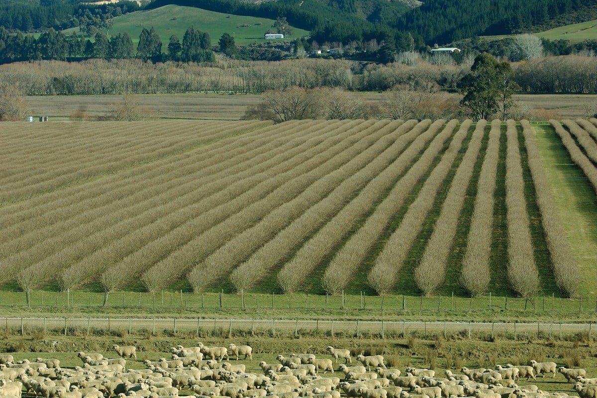
Sources and Flows
Managing contaminant pathways and attenuation to create headroom for productive land use.
Project Details Ngā taipitopito
Project Status:
Challenge funding:
$$3,150,000Research duration:
October 2016 - December 2019Collaborators Ngā haumi
AgResearch | Beef + Lamb NZ | Environment Canterbury | Environment Southland | ESR | Greater Wellington Regional Council | Landcorp | Lincoln Agritech | Manaaki Whenua Landcare Research | NIWA | Northland Regional Council | Tasman Regional Council | Tipa and Associates | Waikato Regional Council
What are we doing?E aha ana mātou?
About half (55%) of agricultural contaminants (nitrogen, phosphorus, sediment, faecal microbes) are naturally removed as they flow from land to sea – but this percentage varies greatly for different soils and landscapes.
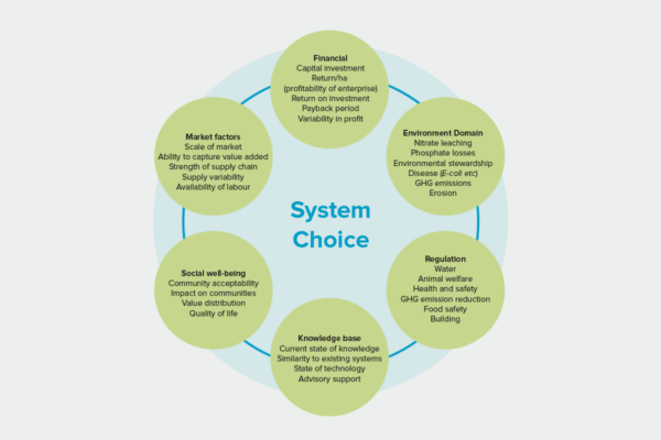
Land-owners need site-specific information about the sources of these contaminants, their rate of transport to receiving waters, and how they are diluted while transported. This knowledge will enable the identification of critical source areas to target cost-effective mitigation interventions, and contribute to our understanding of the potential effects of different land uses on the environment (land use suitability).
The Sources and Flows programme brought together climate, soil, hydrology and water quality scientists to develop a multi-component framework that integrates and fills key gaps in knowledge about the source, transport and transformation of agricultural contaminants. The components of this framework can be incorporated into existing water quality tools and used in the development of new tools.
Sources and Flows researchers also assessed the effectiveness of efforts over the past 20 years to mitigate the impacts of farming on water quality.
How can the research be used? Ka pēhea e whai take ai te rangahau?
- The multi-component, modular framework developed by the Sources and Flows programme is a screening tool for quick assessment of water quality at catchment scale. It will allow landowners to pinpoint a location, identify the contaminants of concern, and select appropriate mitigations.
- The mitigation assessments done by Sources and Flows researchers will help assess whether water quality objectives can be achieved in water bodies, or whether land use change might be required in the catchment area.
- This research refined a ‘critical source area’ theory that explains that the majority of contaminants come from a minority of a farm or catchment. When targeted to these small but critical areas, mitigations are 6 to 7 times more cost-effective. This theory is now used in 77 guidelines, industry strategies and policy documents for environmental farm plans to improve water quality.
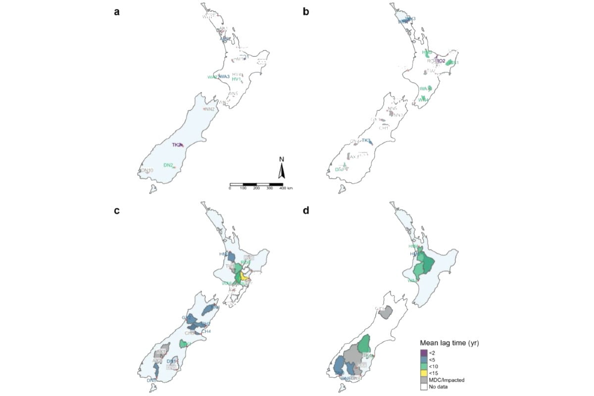
- Sources and Flows researchers modelled soil drainage at 3 North Island and 3 South Island sites and found 35% to 80% more drainage peaks than expected. This suggests better monitoring of soil moisture and scheduling of irrigation is required. Because of this research the Northland Regional Council is refining drought intensity, duration and frequency curves for Northland to guide regional irrigation schemes and the allocation of water.
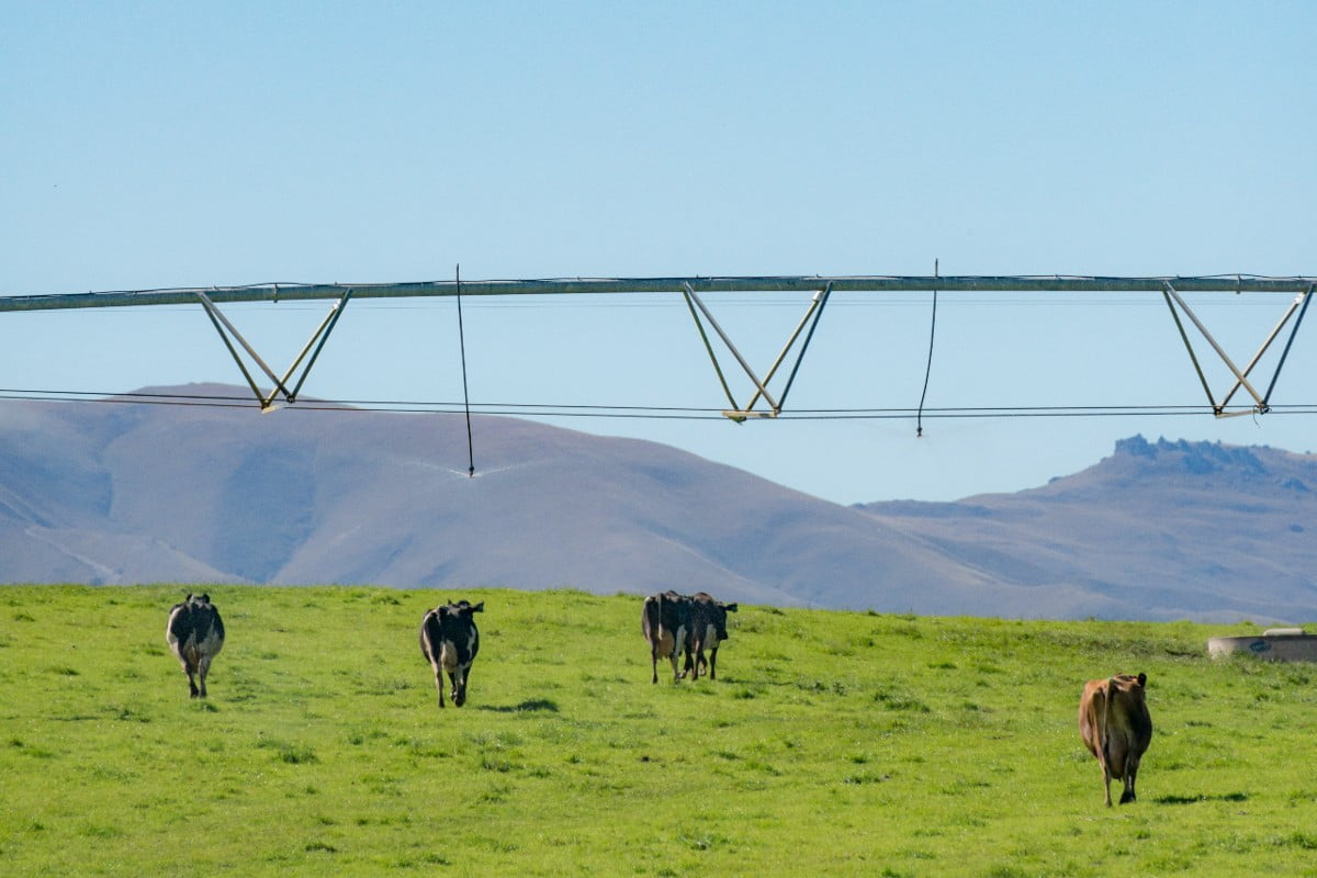
- Sources and Flows research used precision irrigation technologies, timed and matched to soil type at a location in Central Otago, to show that the loss of nitrogen and phosphorus in soil drainage was reduced by 70% to 80% compared to standard irrigation practice. Irrigation NZ highlighted this nationally.
- The Sources and Flows team is working with DairyNZ to develop geospatial data layers that capture the transport of N, P and faecal microbes from sources to water bodies. DairyNZ has been providing the research team with key data layer support as well as research questions that need to be answered.
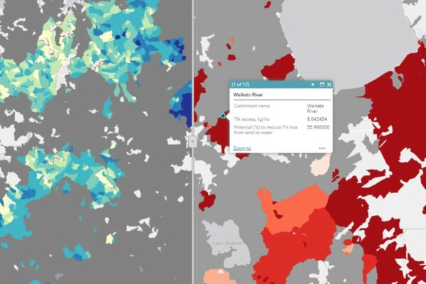
- Researchers in this programme created a map of New Zealand’s potential groundwater recharge zones, where water moves downward from the surface to become groundwater. The map can be used as an initial guide for nationwide assessment and management of groundwater resources, and to identify areas of high nutrient leaching in zones with high groundwater recharge potential.
- The Sources and Flows team has provided lookup tables of N and P losses to support the assessment tool being developed by Land Use Suitability research. This research will also guide the development of catchment modelling tools.
Related research updates Ngā pānui mō te rangahau nei

Participation & engagement Te hunga i whai wāhi mai
- Greater Wellington Regional Council, Waikato Regional Council, Tasman Regional Council and Environment Southland have collaborated with the Sources and Flows programme to test the accuracy of national-scale mapping of groundwater redox in their regions. ECan chief scientist Dr Tim Davie participated in the initial stakeholder advisor group.
- Environment Southland is a partner in developing and testing the Sources and Flows framework in the Oreti and Aparima catchments.
- Sources and Flows work has also been tested in the Waiotapu (Waikato Regional Council ) and Waitangai (Northland Regional Council) catchments.
- Sources and Flows has worked with Northland Regional Council to apply the drought risk component of their framework as a tool for the Northland region.
- Sources and Flows had a stakeholder advisory group to guide initial dialogue with industry groups including Pamu, Beef + Lamb NZ, DairyNZ and Rabobank regarding their needs from the Sources and Flows framework.
Research team Te hunga i whai wāhi mai
Research Co-Lead
Diana Selbie
AgResearch
Research Co-Lead
MS Srinivasan
NIWA
Richard McDowell
AgResearch
Ross Monaghan
AgResearch
Roland Stenger
Lincoln AgriTech
Scott Wilson
Lincoln AgriTech
Les Basher
Manaaki Whenua Landcare Research
Andrew Manderson
Manaaki Whenua Landcare Research
Murray Close
ESR
Shailesh Singh
NIWA
Richard Muirhead
AgResearch
Chris Tanner
NIWA
Michael Friedel
Lincoln AgriTech
Gail Tipa
Ngai Tahu
Tipa & Associates
Annette Semadeni-Davies
NIWA
Arman Haddachi
NIWA
Megan Devane
ESR
Tools & resources Ngā utauta me ngā rauemi
Guidance
Management Practices to Improve Water Quality (learning module)
This kōwae (learning module) will help you support farmers in creating cost-effective freshwater environment plans using science from Our Land and Water. You will learn:…
Guidance
Tools for Making Land Use Change Decisions (learning module)
Work through the activities in this kōwae (course) to learn how to help farm businesses to make decisions about land use diversification. You will learn:…
Guidance
Using variable rate irrigation to mitigate nutrient losses
Variable rate irrigation (VRI), where the application rate of irrigation water across an area changes depending on soil type and other factors, can also decrease…
Interactive Tool
Actions to Include in a Farm Environment Plan
This interactive infographic is a compilation of actions to decrease the loss of contaminants from agricultural land. Mitigation actions can be filtered by any of…
Journal Article
Quantifying contaminant losses to water from pastoral landuses in New Zealand II. The effects of some farm mitigation actions over the past two decades
In New Zealand the primary sector together with central and local government agencies have been promoting measures to mitigate the adverse effect of farming practices…
Video
What the data tells us about our water
By bringing together multiple data sources, we can now see which catchments are under the most pressure, and whether applying all known and emerging on-farm…
Academic outputs He whakaputanga ngaio
Journal Article
Human Impacts Recorded in Chemical and Isotopic Fingerprints of Soils from Dunedin
We present results from the first urban chemical and isotopic soil baseline survey to be completed for a New Zealand city. The major, minor, trace…
Journal Article
Meteorological drought in Northland, NZ: A regional and local analysis using copulas
Meteorological drought is a significant and recurring hazard in Northland, where eight droughts have been recorded since 1900. An analysis characterised by severity, duration, and…
Journal Article
Assessing the leaching of cadmium in an irrigated and grazed pasture soil
To decrease topsoil cadmium (Cd) concentrations we need to make inputs < outputs. Phosphorus fertiliser is the main input of Cd and leaching the main…
Journal Article
Do soil cadmium concentrations decline after phosphate fertilizer application is stopped: A comparison of long-term pasture trials in NZ
Stopping phosphorus (P) fertiliser can decrease topsoil cadmium (Cd) concentrations. Stopping P fertiliser applications reduced soil Cd concentrations after 21 and 26 years. Reductions only…
Journal Article
Quantifying contaminant losses to water from pastoral land uses in NZ I: Development of a spatial framework for assessing losses at a farm scale
Assessing the effectiveness of mitigation measures for reducing contaminant losses to water from pastoral farming systems is a challenging task. Two important factors that contribute…
Journal Article
Quantifying contaminant losses to water from pastoral land uses in NZ II: The effects of some farm mitigation actions over the past two decades
In New Zealand the primary sector together with central and local government agencies have been promoting measures to mitigate the adverse effect of farming practices…
Related news
Future Landscapes Projects
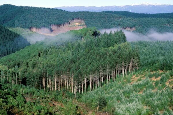
Visualising Forestry Harvesting Cycles
Future risk planning through the visualisation of forestry harvesting cycles. For full information see the programme website
This project has produced
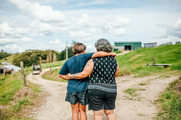
Matarau: Empowering Māori Landowners in Land Use Decisions
Providing accessible and useful data to support Māori landowners to prioritise land-use options. For full information see the programme website
This project has produced
Next Generation Systems
Identifying next generation primary production systems and opportunities to change the face of farming
This project has produced
Healthy Estuaries
Assessing the interactions between loadings of different contaminants from freshwaters on the health and functioning of estuaries
This project has produced
Land Use Suitability
Land use suitability tools and assessment processes for increasing land use diversity and delivering better community outcomes.
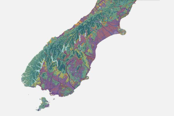
Physiographic Environments of New Zealand
Integrating landscape process knowledge with water chemistry to understand how and why surface water quality varies across New Zealand