 View Our Strategy Document 2019 – 2024

August 30, 2024


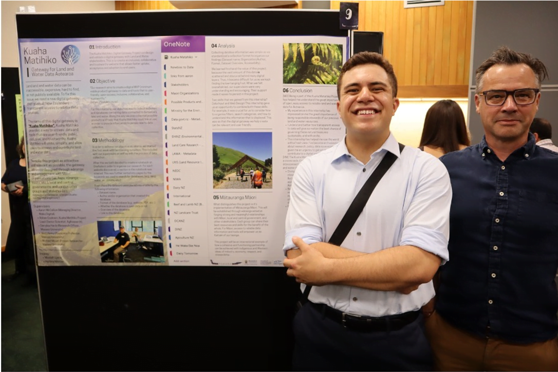
Kuaha Matihiko: Digital Gateway
A digital gateway to data and tools that is user-friendly, open-access, inclusive, collaborative and trustworthy
Paul Sutherland Photography
Project Details Ngā taipitopito
Project Status:
Challenge funding:
$703,000Research duration:
July 2022 – December 2023Collaborators Ngā haumi
AgResearch | Massey University | Waka Digital
What are we doing?E aha ana mātou?
A new digital gateway is needed to give all New Zealanders transparent access to trusted data sources.
Land and water data can be inaccessible, expensive, hard to find, or not publicly available. This research aims to create a digital gateway to data and tools that is user-friendly, open-access, inclusive, collaborative, and trustworthy.
Called Kuaha Matihiko, the digital gateway aims to consolidate access to disparate systems and data layers behind a single ‘shop-front’ that enables people to both access and contribute data.
A ‘minimum viable product’ online platform will be developed.
The project will be highly participatory, with the gateway co-designed through wānanga and engagement with Māori, local and central government, and other stakeholders, to ensure that Kuaha Matihiko is relevant and attractive to various groups to meet their needs.
How can the research be used? Ka pēhea e whai take ai te rangahau?
- Kuaha Matihiko will bring together disparate datasets, enabling people to both contribute and access data. It will be a web-based platform, with an API (Application Programming Interface) and mapping services, that enables users to download or import relevant land or water data. It will be open-source and designed to be attractive to various groups.
- The project will work across scales, but several case studies will take a ‘bottom up’ approach through engagement with Māori landowners and community groups as potential end users. This will identify needs and opportunities that will be worked through by the research team. For example, the digital platform could potentially be used to record land parcel scale data, which could be used for integrated farm planning, and communicating with existing tools (such as FarmIQ, Mitigator, Overseer), and could also assist Māori with realising the economic potential of their land.
- Within the 18 months of this research project, a functional ‘minimum viable product’ (MVP) online platform will be developed, and a clear business case will be developed for its continuation and extension. The business case will detail the partnerships and funding streams required for full development of the platform.
- Case studies will provide concrete examples of how to access and utilise data and adapt the platform to address practical needs of groups such as hapū and iwi, regional authorities and central government.
- Social media platforms will be used to connect Kuaha Matihiko to its customers, supported by students from Pūhoro STEMM Academy who will provide a sounding board for social media use to grow a user base for the platform.
Related research updates Ngā pānui mō te rangahau nei
Participation & engagement Te hunga i whai wāhi mai
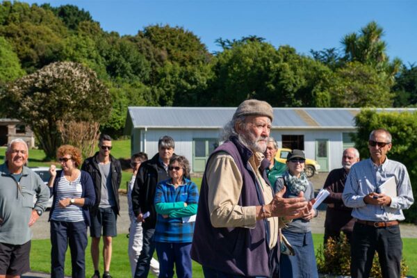
- This programme will take a wānanga and engagement-focused approach to its research. This will explore how co-management and power-sharing among stakeholder groups can be implemented through co-design of the data gateway.
- Wānanga throughout the research programme will bring together mana whenua, hapū, iwi, local authorities, central government, and other interested stakeholders, to share kōrero and knowledge. These wānanga will enable champions for the gateway to be identified and educated, and will help disseminate the research findings, creating greater impact for Māori communities.
- Researchers will engage with different stakeholder groups in person and through online workshops to review and test the accessibility, uptake, suitability, viability and feasibility of the data gateway.
Research team Te hunga i whai wāhi mai
Co-Project Lead
Adrian Cookson
AgResearch
Co-Project Lead/Implementation Lead
Aaron McCallion
Waka Digital
DerryLea Hardy
Massey University
Matthew Henry
Massey University
Lee Tane
AgResearch
Tools & resources Ngā utauta me ngā rauemi
Technical Report
Kuaha Matihiko: Digital Gateway final report
The Kuaha Matihiko: Digital Gateway project identified the urgent need for an integrated and user-friendly centralised gateway that provides easy access to all the critical…
Video
Find Data: Digital Gateway Webinar
The Find Data platform aims to streamline access to vital land and water information for a diverse range of users. A ‘minimum viable product’ is…
Interactive Tool
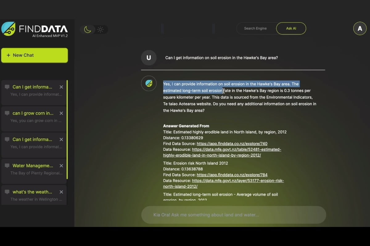
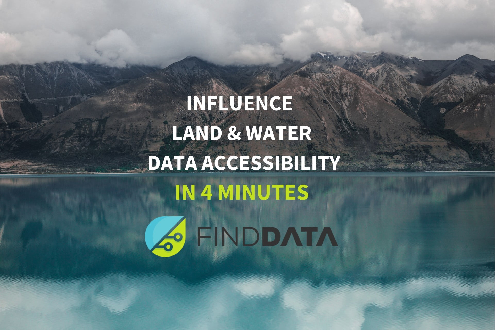
Find Data platform
Find Data provides fast and efficient access to vital information on land and water data, tailored to serve the diverse needs of its users. Currently…
Video
Introduction to the Find Data platform (MVP V1.2)
The Kuaha Matihiko: Digital Gateway project aimed to build a comprehensive online tool that provides access to New Zealand’s rich repository of land and water…
Academic outputs He whakaputanga ngaio
Technical Report
A Data Ecosystem for Land and Water Data to Achieve the Challenge Mission
To address the question ‘What are the best data structures for land and water information to achieve the Challenge Mission?’ a small group of experts…
In the media Mai i te ao pāpaho
Related news
Incentives for Change Projects
Kaitiaki Intelligence Platforms
Positioning Māori as first movers in next-generation environmental intelligence. For full information see the programme website
This project has produced
New Models of Collective Responsibility
Developing new ways to strengthen the connection between people, land and water
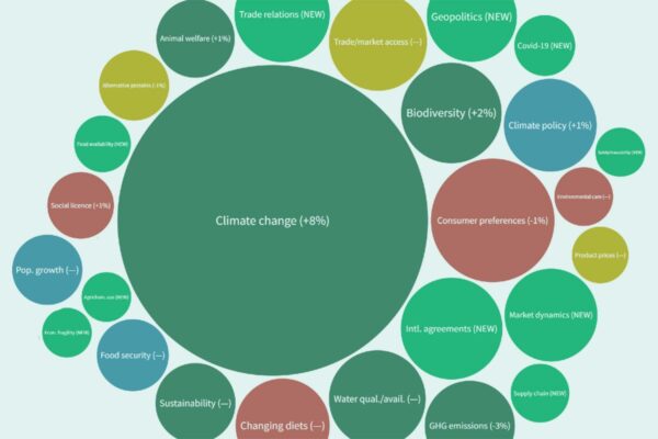
The Matrix of Drivers
A foundational understanding of international and domestic drivers and issues, and their importance to the primary sector
This project has produced
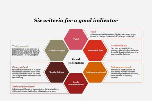
Indicators Working Group
Investigating the use of indicators to help the primary and public sector meet local, national and international reporting requirements
Reasons for Water Quality Improvement
Investigating the reasons for decreasing phosphorus concentrations in many waterways
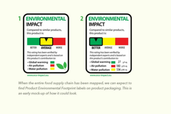
Eutrophication Product Footprinting
Eutrophication indicators will help New Zealand agribusiness reduce environmental impacts and meet expected new European environmental standards