 View Our Strategy Document 2019 – 2024

August 30, 2024


Interoperable Modelling
Designing an open source modelling system to assess productivity potential and water quality contaminant dynamics at farm and catchment scales
Project Details Ngā taipitopito
Project Status:
Challenge funding:
$900,000Research duration:
February 2017 – April 2020Collaborators Ngā haumi
AgResearch | DairyNZ | Environment Southland | GNS Science | Manaaki Whenua Landcare Research | Ministry for the Environment | NIWA | Overseer Ltd | Plant & Food Research | Scion | Victoria University Of Wellington
What are we doing?E aha ana mātou?
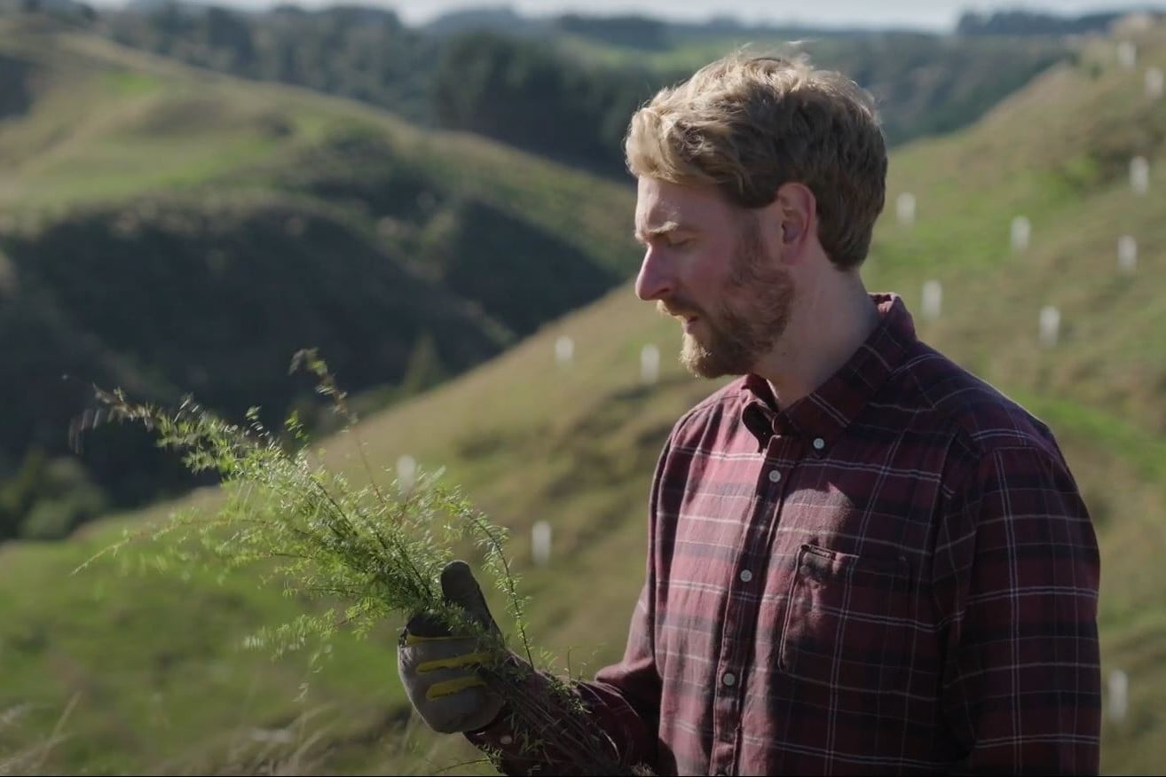
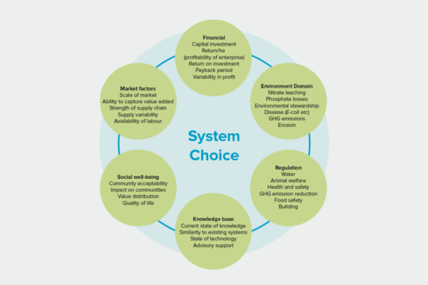
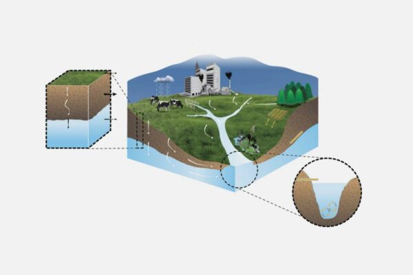
Transitioning New Zealand’s agricultural landscape to a more diverse and resilient mosaic of land uses requires understanding how land management and water quality interact, and how targeted management can achieve our shared values. This requires our ability to model these interactions using open-source interoperable models feeding off low- or no-cost, readily available and high-quality data.
Interoperable Modelling research is developing a national modelling system that assesses the environmental, production and economic implications of land use and land use change, at farm and catchment scales. The goal is to create a trusted tool that helps individuals and communities achieve agreed land and water quality outcomes.
Researchers have identified an agreed initial set of models, data sources, and visualisation components, and are working with a software platform for integrating and accessing the components. Our programme is co-funded by stakeholders to provide a platform where the best models can ‘talk’ to each another.
How can the research be used? Ka pēhea e whai take ai te rangahau?
- The Interoperable Modelling science team is working to implement a functioning and interoperable set of models. The platform is being built on the best available data to provide much faster, cheaper analyses and visualisation experiences. Outputs will enable the measurement of national scale change (eg land use) and regulatory limits.
- There are 10 parties actively involved with the development of the platform through contributing data, sharing code, creating solutions and co-funding. A comprehensive report on interoperable modelling was prepared collaboratively with input from technical experts from 14 organisations.
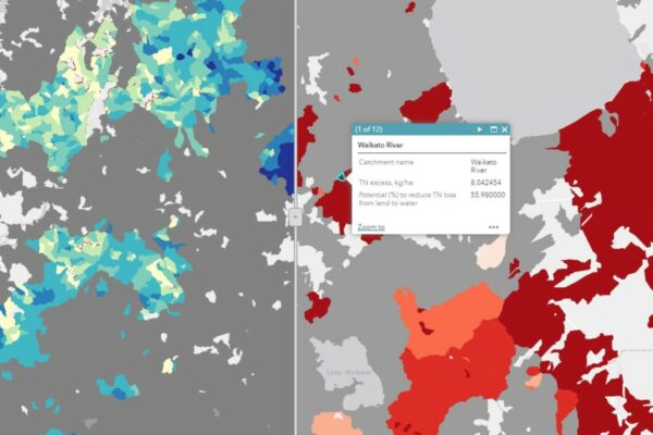
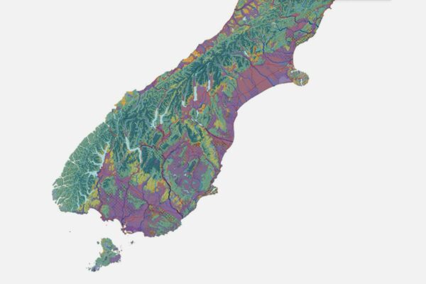
- An initial set of models was implemented in the open-source DeltaShell framework and trialled in Aparima catchment in Southland.
- The initial set of models will focus on contaminant generation and transport, water resources and optimisation, in static and dynamic catchment models.
Research team Te hunga i whai wāhi mai
Research Lead
Sandy Elliott
NIWA
Project Manager
Neale Hudson
NIWA
Juan Monge
Market Economics
Tom Evans
NIWA
Jing Yang
NIWA
Richard Muirhead
AgResearch
Christophe Thiange
DairyNZ
Mike Toews
GNS Science
Ronaldo Vibart
AgResearch
Bethanna Jackson
Victoria University of Wellington
Rogerio Cichota
Plant and Food Research
Alex Herzig
Manaaki Whenua Landcare Research
Christian Zammit
NIWA
Harry Yoswara
AgResearch
Daniel Lagrava Sandoval
NIWA
Sharleen Yalden
NIWA
Channa Rajanayaka
NIWA
Annette Semadeni-Davies
NIWA
Stephen McDonald
AgResearch
Utkur Djanibekov
Manaaki Whenua
Tools & resources Ngā utauta me ngā rauemi
Technical Report
Interoperable Models for Land and Water: Framework selection and preliminary design (consultation draft)
Key objectives for this research include providing a nationally applicable system of models, in an open source interoperability framework, which draws on national datasets where…
Academic outputs He whakaputanga ngaio
Model
Land-Water Interoperable Models
This report summarisises the work of the Interoperable Modelling Systems for Integrated Land and Water Management programme. The programme aimed to develop an interoperable modelling…
Technical Report
Interoperable Modelling – spatial economic optimisation
In this report we describe the application of the spatial modelling and optimisation framework LUMASS as a spatial optimisation tool in the Interoperable Modelling Project.…
Technical Report
Interoperable Models for Land and Water Framework selection and preliminary design
This report presents a proposal for the development of an interoperable modelling system suitable for integrated spatial assessment the economic, production and environmental implications of…
Related news
Future Landscapes Projects
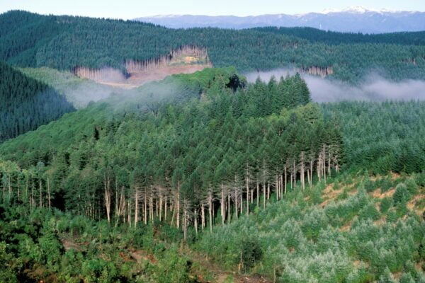
Visualising Forestry Harvesting Cycles
Future risk planning through the visualisation of forestry harvesting cycles. For full information see the programme website
This project has produced
Matarau: Empowering Māori Landowners in Land Use Decisions
Providing accessible and useful data to support Māori landowners to prioritise land-use options. For full information see the programme website
This project has produced
Next Generation Systems
Identifying next generation primary production systems and opportunities to change the face of farming
This project has produced
Land Use Suitability
Land use suitability tools and assessment processes for increasing land use diversity and delivering better community outcomes.
Sources and Flows
Managing contaminant pathways and attenuation to create headroom for productive land use.
Physiographic Environments of New Zealand
Integrating landscape process knowledge with water chemistry to understand how and why surface water quality varies across New Zealand