Monitoring Freshwater Improvement Actions

Monitoring the effectiveness of interventions and mitigation actions on freshwater improvement.

For full information see the programme website

Project Details Ngā taipitopito

Project Status:
Completed
Challenge funding:
$2,956,000
Research duration:
July 2020 – March 2021 (proof of concept)
Oct 2021 – Dec 2023 (tool development)

Collaborators Ngā haumi

AgResearch | Auckland Council | Bay of Plenty Regional Council | Bridger Consulting | Cawthron Institute | DairyNZ | Department of Conservation | Elements Environmental Consultants | GNS Science | Griffith University | Headwater Hydrology | Horizons Regional Council | Komanawa Solutions | Land Water People | Lincoln University | Marlborough District Council | Ministry for the Environment | Ngāti Kuia | Ngati Raukawa | NZARM (New Zealand Resource Managers Association) | Pokaiwhenua Catchment Board | Te Hoiere Restoration Project | Traverse Environmental | Waikato Regional Council | Waikato River Authority

You are here: Home / Projects / ­ Monitoring Freshwater Improvement Actions

What are we doing?E aha ana mātou?

Actions are being taken to improve freshwater quality, such as stream fencing and planting, wetland restoration and changes in farming practices. How do we know if these actions are successful?

Government regulations introduced in 2020 require action to be taken to improve freshwater where it is degraded, and task regional councils with monitoring both the mitigation actions and their freshwater outcomes.

Our current freshwater monitoring methods and networks are designed to give us information on the state and trend of freshwater but can be ill-suited to robustly establish relationships between improvement actions and their effect.

This research programme has developed an interactive WebApp to help people involved in freshwater improvement actions design monitoring programmes to measure improvements in rivers, lakes and groundwater, and to help them select appropriate monitoring technologies that enable early detection of improvement.

Over time, these monitoring programmes will provide information on successes and failures of past actions, helping prioritise the most effective actions to improve freshwater quality, so our rivers more quickly return to good health.

The WebApp and supporting information are freely available at monitoringfreshwater.co.nz

How can the research be used? Ka pēhea e whai take ai te rangahau?

  • This research will help everyone involved in freshwater improvement actions (councils, iwi, co-governance entities and catchment groups) robustly monitor rivers, lakes and groundwater aquifers to detect early improvement. For example, the toolkit will enable a regional authority to find out whether its existing freshwater monitoring network is suitable to detect water quality improvements resulting from the implementation of a freshwater plan.
  • The WebApp and associated resources can support decisions about what to measure, where, when, with what technology, and how much it will cost. It is supported by open-source code and is freely available.
  • The research explores which monitoring designs best facilitate a te ao Māori-framed approach to detecting the effects of whenua-based mitigation actions on wai Māori.
  • An online interface allows people to define a level of expected reductions in the losses of the four main contaminants (nitrogen, phosphorus, sediment and coli) from various types of land use and land cover within a catchment, or to directly define the level of water quality improvement they are hoping to see. The online tool provides guidance on best monitoring locations, durations and frequencies for key water quality and ecological indicators to detect improvements.
  • Catchment groups or their freshwater advisors can use the online tool to identify where monitoring would be best targeted, how many sites should be monitored and how often they should be monitored to measure the success of their management actions.
  • A factsheet will summarise monitoring technologies and costs for each key water quality and ecological indicator.

Participation & engagement Te hunga i whai wāhi mai

  • Two case studies have been undertaken: the Pokaiwhenua catchment (a tributary to the Waikato River) and the Pelorus / Te Hoiere Catchment. In each case study, researchers engaged with the catchment’s community, including tangata whenua, catchment groups and regional council.
  • Case studies focussed on the application and testing of the tools and resources produced as part of this research programme in a real-life catchment management context. The main output is the design of a monitoring programme optimised to assess the success of mitigations applied in each catchment.
  • The case studies involved hui led by tangata tiaki to keep tangata whenua informed and to disseminate outputs.
  • The Implementing Te Mana o Te Wai project held wānanga with mātauranga Māori experts from around the country to discuss their relationship with wai, and how this needs to be reflected in the implementation of Te Mana o te Wai.

Research team Te hunga i whai wāhi mai

Programme Leader, Implementation Lead
Olivier Ausseil
Traverse Environmental
Te Ao Māori Lead
Joanne Clapcott
Ngāti Porou
Cawthron Institute
Science Lead
David Hamilton
Griffith University
Mathematics Team Lead
Alasdair Noble
AgResearch
Phase 1 Co-lead
Rogier Westerhoff
GNS Science
Richard McDowell
AgResearch
GIS Tool Development
Crile Doscher
Lincoln University
Webtool Developer
Mike Kittridge
Headwaters Hydrology
Engagement
Waverley Jones
Traverse Environmental
Zeb Etheridge
Komanawa Solutions
Matt Highway
Element Environmental Consultants
Ruihana Smith
Ngāti Kuia
Te Hoiere Project
Kristie Pakipaki
Ngāti Kuia
Te Hoiere Project
K'Lee Begbie
Ngāti Raukawa
Raukawa Charitable Trust
Anaru Begbie
Ngāti Raukawa
Raukawa Charitable Trust

Tools & resources Ngā utauta me ngā rauemi

Summary

Online Tools Show Where Land-Use Change Needs to be Considered

We now know where land use needs to change, to meet New Zealand policy expectations for water quality. This article was prepared as an impact…
View Summary
Video

Our Land and Water Podcast Episode 1: How bad is our water quality, really?

For the past eight years, Our Land and Water has funded research with the goal of improving the health of our rivers and lakes here…
View Video
Video

Our Land and Water Podcast Series

Our Land and Water introduces insights from eight years of science in this podcast series. In each episode you will hear from the scientists and…
View Video
Guidance

Management Practices to Improve Water Quality (learning module)

This kōwae (learning module) will help you support farmers in creating cost-effective freshwater environment plans using science from Our Land and Water. You will learn:…
View Guidance
Summary

Supercharge your data collection when participating in community-based monitoring of freshwater environments

A brochure for rural community and catchment groups, explaining how the data they collect can help detect changes in freshwater quality – but only if…
View Summary
Technical Report

Quantifying catchment and community-based stream monitoring in Aotearoa New Zealand

This preliminary project to quantify freshwater community-based monitoring (CBM) efforts in Aotearoa New Zealand has identified that a wide range of monitoring is being carried…
View Technical Report

Academic outputs He whakaputanga ngaio

Journal Article

Optimising sampling frequency for change detection of variables in lake monitoring programs

Optimized sampling regime can match restoration timeline with improvements in water quality. Duration and frequency of the optimized sampling regime affect operational monitoring costs. Detecting…
View Journal Article
Technical Report

The Power of the Current Monitoring Network to Detect Nitrate Reductions in the Selwyn-Waihora Zone

Plan Change 1 (PC1) of the Canterbury Land andWater Regional Plan included requirements for farmers in the Selwyn-Waihora catchment to reduce nitrate discharges to groundwater…
View Technical Report
Journal Article

Monitoring to detect changes in water quality to meet policy objectives

Detecting change in water quality is key to providing evidence of progress towards meeting water quality objectives. A key measure for detecting change is statistical…
View Journal Article
Technical Report

Water Quality Monitoring for Management of Diffuse Nitrate Pollution

Aotearoa New Zealand is making significant investment in national policy and standards, regional plan rules and on-farm actions to reduce the impact of intensive land…
View Technical Report
Journal Article

Towards implementation of robust monitoring technologies alongside freshwater improvement policy in NZ

International studies point out that some freshwater policy objectives are not achieved. This study describes that this is in part caused by shortcomings that include:…
View Journal Article
Technical Report

Measuring the benefits of management actions: Mitigation effectiveness monitoring design (proof of concept phase)

A five-step process was developed to answer the key question asked of Working Group 1:’Have the mitigation actions resulted in improved freshwater outcomes?’. To assist…
View Technical Report

In the media Mai i te ao pāpaho

Farmers Weekly, 26 August 2021
Ausseil says state of the environment monitoring is very good at providing what the current state of freshwater is and what the long-term changes are but because it hasn’t been designed specifically with a mitigation plan in mind, although it might pick up improvements, there’s often a struggle to establish a cause and effect relationship to say exactly what caused the improvement.

Future Landscapes Projects

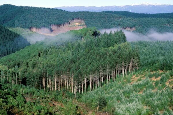
Shutterstock 1031980621New Zealand, South Island, pine forest near Wakefield in the north of the south island.

Visualising Forestry Harvesting Cycles

Future risk planning through the visualisation of forestry harvesting cycles. For full information see the programme website
View Project
This project has produced
Information Type Icon Guidance OutlineInformation Type Icon Interactive Tool OutlineInformation Type Icon Method OutlineInformation Type Icon Summary Outline
Kids & Co Photos / Laura Bolt / TrueStock

Matarau: Empowering Māori Landowners in Land Use Decisions

Providing accessible and useful data to support Māori landowners to prioritise land-use options. For full information see the programme website
View Project
This project has produced
Information Type Icon Interactive Tool Outline
Next Generation Systems Illo

Next Generation Systems

Identifying next generation primary production systems and opportunities to change the face of farming
View Project
This project has produced
Information Type Icon Journal Article OutlineInformation Type Icon Presentation OutlineInformation Type Icon Technical Reports Outline
Measuring Denitrification In Groundwater

Measuring Denitrification

The development of a method for measuring denitrification is a first for New Zealand, providing vital data for understanding natural denitrification processes
View Project
This project has produced
Information Type Icon Infographic OutlineInformation Type Icon Method OutlineInformation Type Icon Presentation OutlineInformation Type Icon Summary OutlineInformation Type Icon Technical Reports Outline

Healthy Estuaries

Assessing the interactions between loadings of different contaminants from freshwaters on the health and functioning of estuaries
View Project
This project has produced
Information Type Icon Guidance OutlineInformation Type Icon Summary OutlineInformation Type Icon Technical Reports Outline
The Duke of Edinburgh (third from left) observes border dyke irrigation at the Winchmore Research Station Irrigation Scheme. In a border dyke irrigation system, when water is diverted from the main water races into smaller ones, a temporary dam must be created at the outlet to each border, so the water spills through onto pasture. In this image the outlet behind the worker in the water has been closed with a board, the pasture on the right of it has been flattened by the previous flow of water. The worker is lifting a corner of the canvas dam to allow water to flow down to the next temporary dam.

Linking Legacies to Wai

Accounting for lag times and natural concentrations of contaminants in groundwater
View Project
Scroll to Top