Benign Denitrification in Groundwaters

Developing a cost-effective technique to assess denitrification processes and end products in shallow groundwaters

Project Details Ngā taipitopito

Project Status:
Completed
Challenge funding:
$170,000
Research duration:
January 2017 – January 2020

Collaborators Ngā haumi

GNS Science | Horizons Regional Council | Manaaki Whenua Landcare Research | Massey University | Waikato Regional Council

You are here: Home / Projects / ­ Benign Denitrification in Groundwaters

What are we doing?E aha ana mātou?

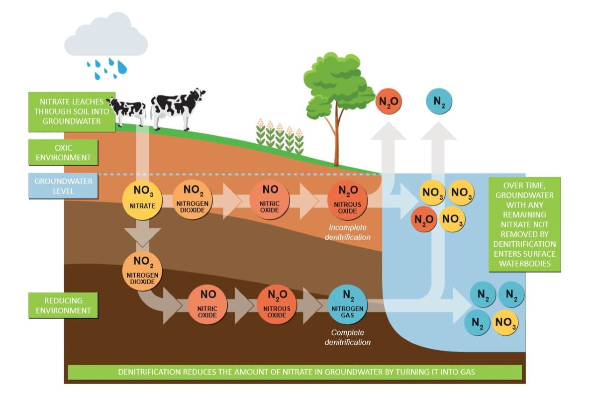
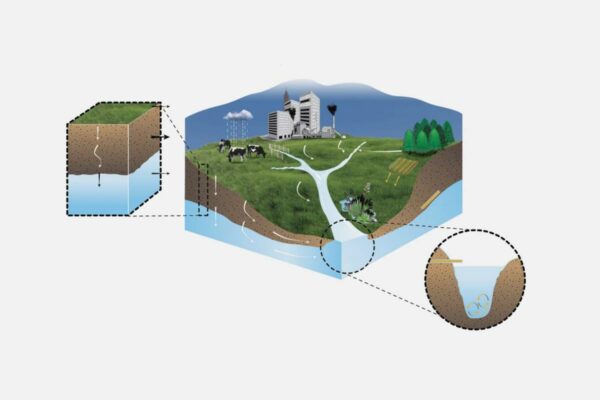
Denitrification is the natural process of soil bacteria converting nitrate back into atmospheric nitrogen gas.  This process could reduce (attenuate) the environmentally damaging impacts of nitrate leached from farms to freshwater.

It is important that the denitrification process is complete, because incomplete denitrification can release nitrous oxide (N2O, a harmful greenhouse gas) rather than dinitrogen (N2, a harmless gas making up 78% of the atmosphere).

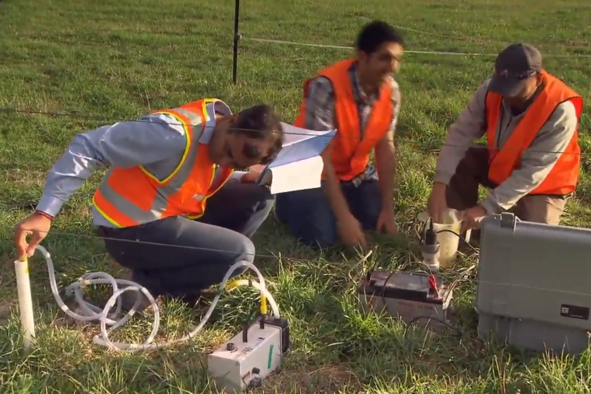
Benign Denitrification in Groundwaters research developed a catchment-scale model to assess denitrification processes and end products (nitrous oxide and/or dinitrogen) in shallow groundwaters in the Manawatu and Rangitikei river catchments (located in the lower part of the North Island, New Zealand).

This conceptual model could be developed into a method to map and effectively utilise complete benign denitrification capacity at the farm scale, to help achieve environmentally friendly dairy farming across agricultural landscapes.

How can the research be used? Ka pēhea e whai take ai te rangahau?

  • This research found that the capacity of natural processes to reduce nitrogen varies a great deal spatially, even within the same catchment. Some parts of a catchment may therefore contribute disproportionately to river contamination of nitrogen, while areas with high nitrogen attenuation capacity may be suitable for strategic intensification of land use.
  • Farming the attenuation capacity will be a defining feature of future land uses and a key component of suitability criteria.
  • The results suggest a reduction of greater than 25% in the river nitrate loads from dairy farming areas could potentially be achieved by spatially aligning dairy land with areas of high subsurface nitrate-attenuation capacity, and by managing critical flow pathways using innovative edge-of-field technologies such as controlled drainage, drainage-water harvesting for supplemental irrigation, woodchip bioreactors, and constructed wetlands in the study catchments.
  • There is potential to build on this work to better understand, map and effectively utilise existing natural and new built-in nitrate-attenuation capacity to significantly reduce water-quality impacts from dairy farming across environmentally sensitive agricultural catchments. This knowledge and tools could help farmers close the gap between what can be achieved with current, in-field mitigation practices and the nitrogen-loss allocation imposed by regulatory authorities.
  • Regional councils can use this research to inform policy and the allocation of nitrogen leaching allowances, to achieve better water quality outcomes. Researchers in the Benign Denitrification in Groundwaters project are working collaboratively with Horizons Regional Council and Waikato Regional Council, having agreed that the denitrification measurement tools will be used by the Councils.
  • The first end users include Massey University’s Fertilizer and Lime Research Centre (FLRC), Horizons Regional Council, Waikato Regional Council, and Our Land and Water researchers and partners.

Related research updates Ngā pānui mō te rangahau nei

Research team Te hunga i whai wāhi mai

Research Lead
Ranvir Singh
Massey University
David Horne
Massey University
Stephen Collins
Horizons Regional Council
Uwe Morganstern
GNS Science
Aldrin Rivas
Lincoln Agritech
Andrew McMillan
Manaaki Whenua Landcare Research
Neha Jha
Massey University

Tools & resources Ngā utauta me ngā rauemi

Infographic

The denitrification process

Denitrification is a natural process that reduces the amount of nitrate entering rivers and other freshwater bodies. In some groundwater systems, microorganisms turn nitrate into…
View Infographic
Infographic

Denitrification completeness is related to oxygen

Groundwater denitrification varied across the sites studied by the Benign Denitrification in Groundwaters project. The main end product of groundwater denitrification (nitrogen gas or nitrous…
View Infographic
Summary

Revealing Groundwater’s Denitrification Capacity

A new way to measure denitrification in groundwater has been proved, and could make analysing groundwater’s denitrification capacity more accessible for regional councils and farmers.…
View Summary
Presentation

Nitrogen Attenuation via Benign Denitrification

Our Land and Water Symposium, August 2019
View Presentation
Presentation

Benign denitrification in shallow groundwaters

Land Use and Water Quality Agriculture and the Environment, Denmark, June 2019
View Presentation
Presentation

Denitrification in shallow groundwaters: An ecosystem service or a pollution swap? –poster

Fertilizer and Lime Research Centre workshop 32, February 2019
View Presentation

Academic outputs He whakaputanga ngaio

Journal Article

Contrasting subsurface denitrification characteristics under temperate pasture lands and its implications for nutrient management in agricultural catchments

Subsurface denitrification plays a key role in the reduction or ‘attenuation’ of nitrate contamination of groundwater and surface waters. We investigated subsurface denitrification characteristics at…
View Journal Article
Journal Article

Water quality issues facing dairy farming: potential natural and built attenuation of nitrate losses in sensitive agricultural catchments

We developed a conceptual catchment-scale modelling analysis assessing potential natural and built attenuation of nitrate losses from dairy farming in the Tararua and Rangitikei catchments…
View Journal Article
Technical Report

Denitrification in Shallow groundwaters – an ecosystem service or a pollution swap

Our observations highlight the influence of different hydrogeological settings on spatial variability of partial or complete (benign) denitrification in shallow groundwaters. A better understanding and…
View Technical Report
Technical Report

Efficacy of subsurface denitrification to attenuate nitrate in shallow groundwaters

Our preliminary results indicate occurrence of complete ‘benign’ denitrification in the reducing shallow groundwater sites with lower dissolved oxygen (DO) contents (DO < 1mg L-1),…
View Technical Report
Journal Article

Transport and potential attenuation of nitrogen in shallow groundwaters in the lower Rangitikei catchment

Intensive agricultural activities are generally associated with nitrogen leaching from agricultural soils with potential to contaminate groundwater and surface waters. We studied nitrogen losses and…
View Journal Article
Journal Article

Denitrification potential in the subsurface environment in the Manawatu River catchment

Understanding the effects of hydrogeological factors on loss, transport and fate of farm nutrients is essential for predicting their impacts on ecosystem health of receiving…
View Journal Article

In the media Mai i te ao pāpaho

Farmers Weekly, 28 August 2019
“Taking the attenuation knowledge you have for your farm and using these relatively lower-cost techniques means you avoid that major capital outlay. You also leave your land use options open – if you are committed to an expensive livestock home, for example, it’s more difficult to change to another land use in the future.”
Irrigation NZ News, Autumn 2019 (page 36)
The Massey University-led research analysed the likely result of strategically intensifying land use in more than 83,000ha of high nitrogen attenuation capacity areas in the catchment – while de-intensifying land use over about 10,000ha
Dairy Farmer, 18 February 2019
Because the leached nitrogen flowed through aquifers where a lot of denitrification occurred, most of the leached nitrogen was converted to gaseous forms and lost to air. The result was that the load in the river would have likely decreased by 6%
NZ Geographic, July-August 2017
This capacity to attenuate nitrogen is highly variable across a catchment, Singh said. “This leads you to conclude that some parts of a catchment are contributing disproportionately to river contamination”
TVOne, 2015
“We found that nitrogen reduction capacity varies quite a bit from sub-catchment to sub-catchment,” says Ranvir Singh. “That is very interesting because we did not know that this reduction underground was that variable, and we are not utilising it properly”
EDS Conference, 2 August 2018
Parliamentary Commissioner for the Environment Simon Upton talks about research on the spatial variability of nitrogen attenuation and its importance in catchment-scale modelling of nutrient losses (11:00–14:00)

Future Landscapes Projects

Shutterstock 1031980621New Zealand, South Island, pine forest near Wakefield in the north of the south island.

Visualising Forestry Harvesting Cycles

Future risk planning through the visualisation of forestry harvesting cycles. For full information see the programme website
View Project
This project has produced
Information Type Icon Guidance OutlineInformation Type Icon Interactive Tool OutlineInformation Type Icon Method OutlineInformation Type Icon Summary Outline
Kids & Co Photos / Laura Bolt / TrueStock

Matarau: Empowering Māori Landowners in Land Use Decisions

Providing accessible and useful data to support Māori landowners to prioritise land-use options. For full information see the programme website
View Project
This project has produced
Information Type Icon Interactive Tool Outline
Next Generation Systems Illo

Next Generation Systems

Identifying next generation primary production systems and opportunities to change the face of farming
View Project
This project has produced
Information Type Icon Journal Article OutlineInformation Type Icon Presentation OutlineInformation Type Icon Technical Reports Outline

Faecal Source Tracking

Identifying the sources of faecal contamination in waterways, and identifying naturalised Escherichia coli to help establish water quality for swimming
View Project

Healthy Estuaries

Assessing the interactions between loadings of different contaminants from freshwaters on the health and functioning of estuaries
View Project
This project has produced
Information Type Icon Guidance OutlineInformation Type Icon Summary OutlineInformation Type Icon Technical Reports Outline
The Duke of Edinburgh (third from left) observes border dyke irrigation at the Winchmore Research Station Irrigation Scheme. In a border dyke irrigation system, when water is diverted from the main water races into smaller ones, a temporary dam must be created at the outlet to each border, so the water spills through onto pasture. In this image the outlet behind the worker in the water has been closed with a board, the pasture on the right of it has been flattened by the previous flow of water. The worker is lifting a corner of the canvas dam to allow water to flow down to the next temporary dam.

Linking Legacies to Wai

Accounting for lag times and natural concentrations of contaminants in groundwater
View Project
Scroll to Top