 View Our Strategy Document 2019 – 2024

August 30, 2024


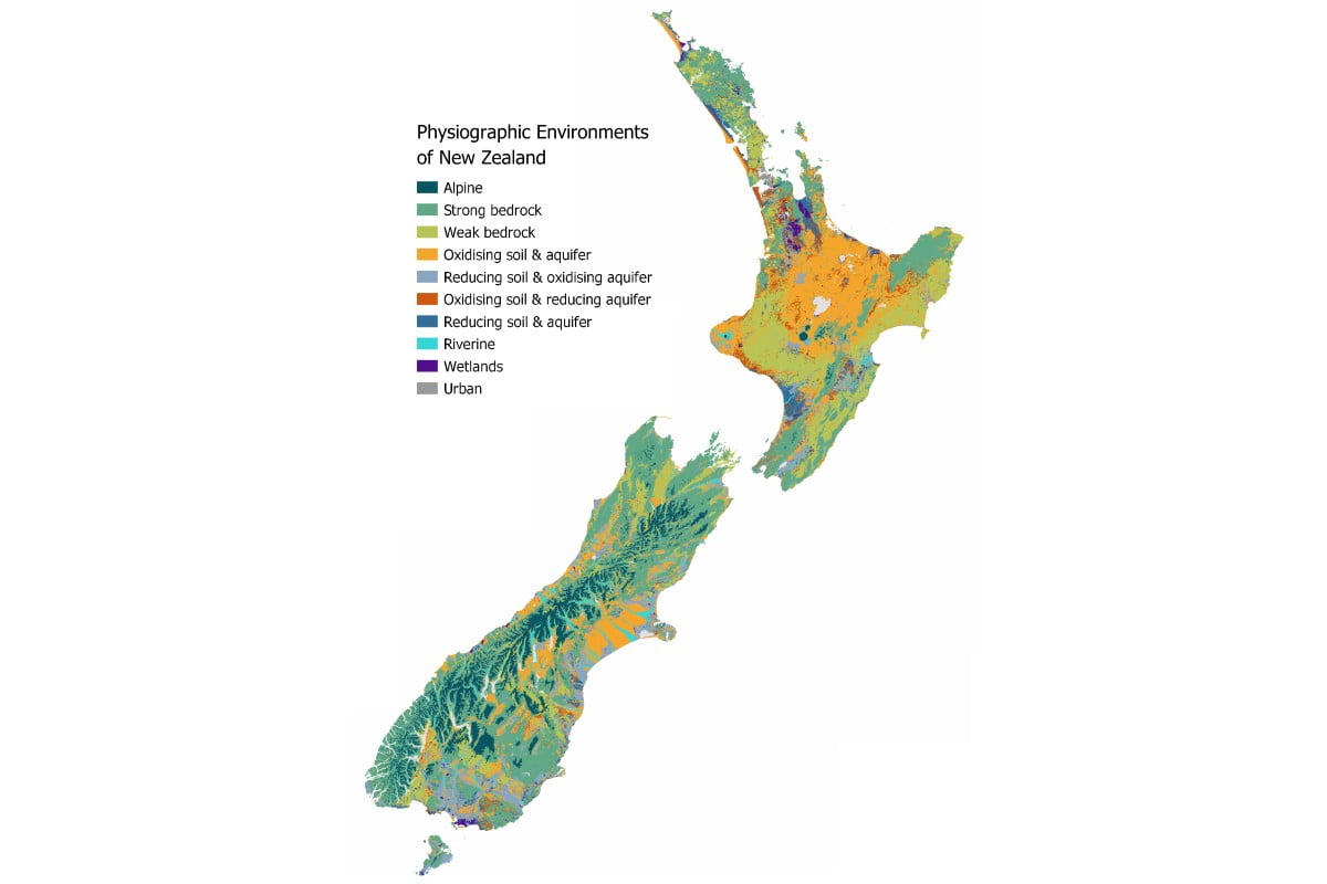
Physiographic Environments of New Zealand
Integrating landscape process knowledge with water chemistry to understand how and why surface water quality varies across New Zealand
Project Details Ngā taipitopito
Project Status:
Challenge funding:
$100,000Research duration:
July 2017 – December 2019Collaborators Ngā haumi
Auckland Council | Bay of Plenty Regional Council | Envirolink | Environment Canterbury | Environment Southland | Horizons Regional Council | Land & Water Science | Northland Regional Council | Waikato Regional Council | Waterways Centre for Freshwater Management
What are we doing?E aha ana mātou?
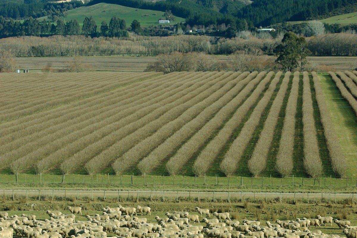
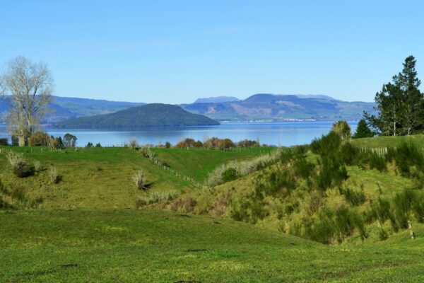
Water composition and quality varies widely between regions and catchments around New Zealand, even where there are similar land uses and pressures on the surrounding land. This is due to the influence of natural landscape features, which can account for more than twice the variability in water quality than land use alone. Therefore, it’s important to include landscape attributes in explanations for water quality outcomes.
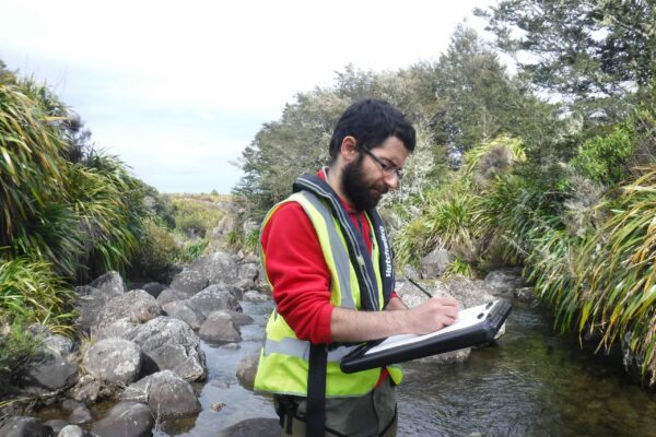
Physiographic science works ‘backwards’, using water composition to trace the water’s journey back through the landscape to understand the landscape controls over water composition, and hence quality.
Physiographic Environments of New Zealand (PENZ) researchers are using national and regional water composition and quality data sets, in conjunction with existing geospatial layers, to map and numerically model the processes that control the spatial variability of water. The method brings together data for climate, topography, geology, soils, and hydrological controls with analytical chemistry at a national scale.
How can the research be used? Ka pēhea e whai take ai te rangahau?
- Regional and district councils (Northland, Auckland, Waikato, Bay of Plenty, Horizons, Canterbury, Southland) are sharing data and collaborating to develop and apply the physiographic approach to their regions.
- Physiographic outputs have been loaded into Northland Regional Council’s ESRI Collector software suite in order to support the council’s farm, forestry and biodiversity extension teams in the field.
- An aligned MPI Sustainable Farming Fund project, Farmer Interface for Physiographic Environments, is underway to provide physiographic maps to farmers. A web-based map is being co-developed with a wide range of collaborators including farmers and industry representatives: Foundation of Arable Research, Deer Industry New Zealand, Ravensdown, Ballance Agri-Nutrients, Living Water, Southland Economic Development Agency, Environment Southland. The key aim is to educate farmers on how contaminants (N, P, sediment and faecal microbes) leave their land so that they can make well-informed land use decisions to reduce losses.
- Fonterra farm extension advisors are using the method to tailor their evolved Sustainable Dairying Programme (Tiaki). Specifically, calibrating farm extension initiatives to the physiographic setting, in order to implement the most effective and least cost steps towards minimising environmental contamination from farms.
- A collaboration with Living Water (a Fonterra and Department of Conservation partnership) allowed the research team to apply the physiographic method to the Waituna Catchment. This work enabled a significant amount of method development to be undertaken and tested. Fonterra has now incorpoarted physiographic information into the Tiaki Farm Source model within the Waituna Catchment, in order to provide more targeted advice to its suppliers and inform farm environment plans.
- Physiographic science is now being taught through Lincoln University’s third-year soil science course.
Related research updates Ngā pānui mō te rangahau nei
Research team Te hunga i whai wāhi mai
Clint Rissmann
Land and Water Science
Lisa Pearson
Land and Water Science
Matt Couldrey
Land and Water Science
Jessie Lindsay
Land and Water Science
Tools & resources Ngā utauta me ngā rauemi
Guidance
Management Practices to Improve Water Quality (learning module)
This kōwae (learning module) will help you support farmers in creating cost-effective freshwater environment plans using science from Our Land and Water. You will learn:…
Video
Digital Toolshed: LandscapeDNA (5 July 2023)
The LandscapeDNA information hub gives you access to interactive maps that allow you to explore land right down to property scale, and understand which contaminants…
Interactive Tool
LandscapeDNA
The LandscapeDNA information hub gives you access to the Physiographic Environment Classification developed with funding from Our Land and Water. Interactive maps allow you to…
Video
Landscape DNA Webinar for Rural Professionals
This webinar for NZIPIM demonstrates the LandscapeDNA website, an interactive tool to help farmers and their advisors view their land from different perspectives and understand…
Video
Physiographics in the Waituna catchment
The Physiographic Environments of New Zealand research project, part of the Our Land and Water National Science Challenge, describes how the physiographics approach has been…
Presentation
Physiographic Environments of NZ: An integrated landscape classification for understanding variation in water quality
New Zealand Soil Science Society Conference, December 2018
Academic outputs He whakaputanga ngaio
Journal Article
Physiographic Environment Classification: a Controlling Factor Classification of Landscape Susceptibility to Waterborne Contaminant Loss
Spatial variation in the landscape factors climate, geomorphology, and lithology cause significant differences in water quality issues even when land use pressures are similar. The…
Journal Article
A hydrochemically guided landscape classification system for modelling spatial variation in multiple water quality indices: Process-attribute mapping
Spatial variation in landscape attributes can account for much of the variability in water quality relative to land use on its own. Such variation results…
Technical Report
Application of Physiographic Science to the Northland Region: Preliminary Hydrological and Redox Process-Attribute Layers
Water quality outcomes can vary spatially across the landscape, even when there are similar land use pressures. These differences are often the result of natural…
Technical Report
Advice for application of the physiographic method to the West Coast Region
Land and Water Science Ltd. was contracted to provide services to West Coast Regional Council through an Envirolink Small Advice Grant. The aim of the…
Technical Report
Evaluation of the physiographic method for the Tasman Region
The work undertaken in this project provides Tasman District Council with a foundation for which the physiographic approach can be applied within the region. The…
Technical Report
Integrated landscape mapping of water quality controls for farm planning – applying a physiographic approach to the Waituna Catchment, Southland
Living Water (a Fonterra and Department of Conservation partnership) commissioned a high-resolution physiographic assessment of the Waituna Catchment, Southland, to support water quality and biodiversity…
In the media Mai i te ao pāpaho
Scoop, 16 May 2022
Irrigation NZ News, Spring 2019 (page 46)
Parliamentary Commissioner for the Environment, December 2018
The physiographic approach was identified as a novel approach to provide useful information about the vulnerability of the land, and help indicate appropriate land-use management (p114)
The PENZ research team were finalists in the Environment and Sustainability section of the New Zealand Spatial Excellence Awards 2018
Scoop 16 May 2022
Related news
Future Landscapes Projects
Visualising Forestry Harvesting Cycles
Future risk planning through the visualisation of forestry harvesting cycles. For full information see the programme website
This project has produced

Matarau: Empowering Māori Landowners in Land Use Decisions
Providing accessible and useful data to support Māori landowners to prioritise land-use options. For full information see the programme website
This project has produced
Next Generation Systems
Identifying next generation primary production systems and opportunities to change the face of farming
This project has produced
Pohewa Pae Tawhiti
Supporting land-use change decisions that are consistent with landowner long-range visions and priorities, through an integrated framework that incorporates tools, models and innovative guidelines and…
This project has produced
Monitoring Freshwater Improvement Actions
Monitoring the effectiveness of interventions and mitigation actions on freshwater improvement. For full information see the programme website
This project has produced
Linking Legacies to Wai
Accounting for lag times and natural concentrations of contaminants in groundwater