 View Our Strategy Document 2019 – 2024

August 30, 2024


Pohewa Pae Tawhiti
Visualising Horizons
Supporting land-use change decisions that are consistent with landowner long-range visions and priorities, through an integrated framework that incorporates tools, models and innovative guidelines and processes
Project Details Ngā taipitopito
Project Status:
Challenge funding:
$3,600,000Research duration:
October 2019 – March 2020 January 2021 – September 2023
Collaborators Ngā haumi
AgResearch | Development Matters | JD Reid Ltd | Kokiri Research Ltd | Mahi Maioro Professionals | Manaaki Whenua Landcare Research | Plant & Food Research | Scion | Te Arawa Primary Sector Group | Will Allen & Associates
What are we doing? E aha ana mātou?
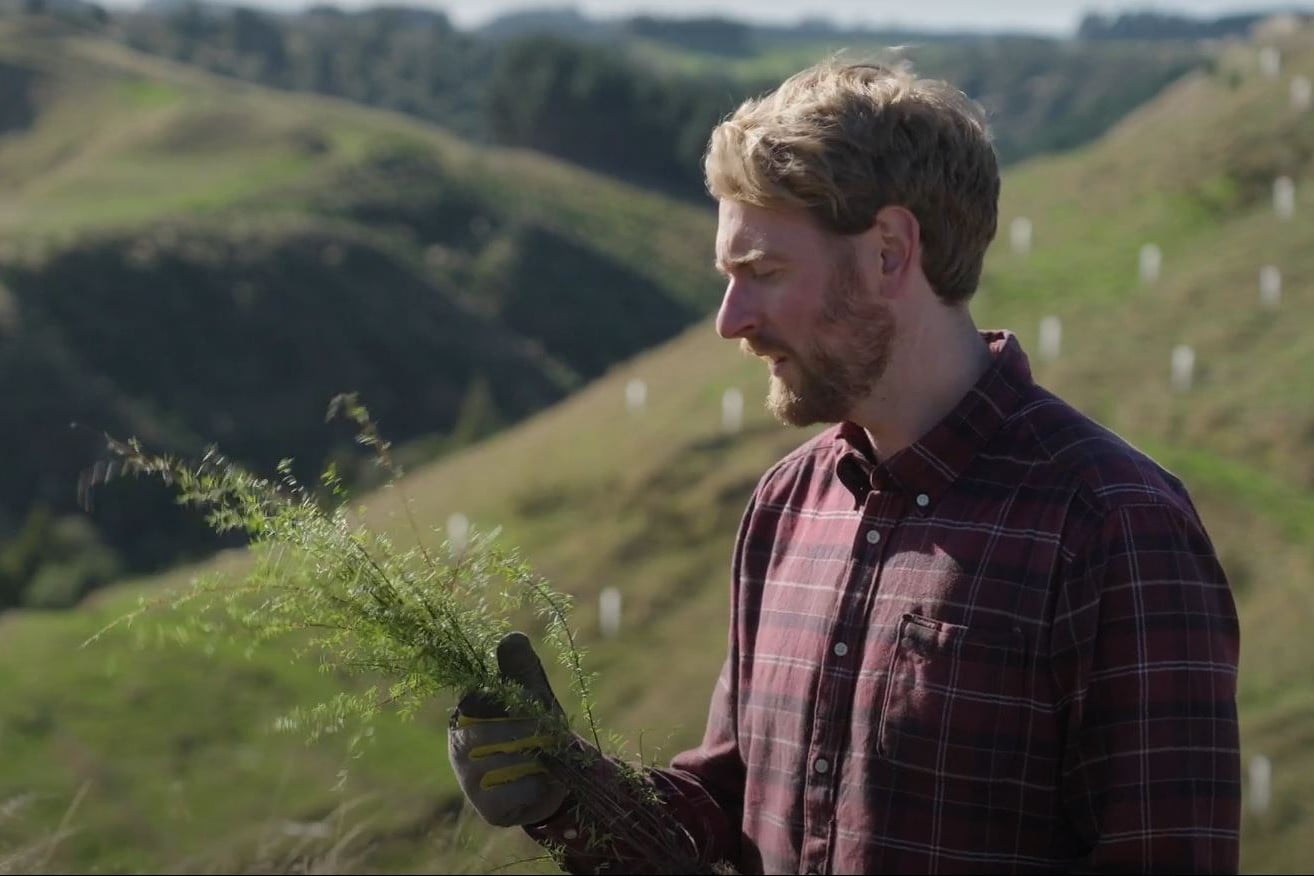
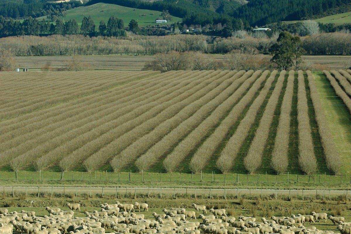
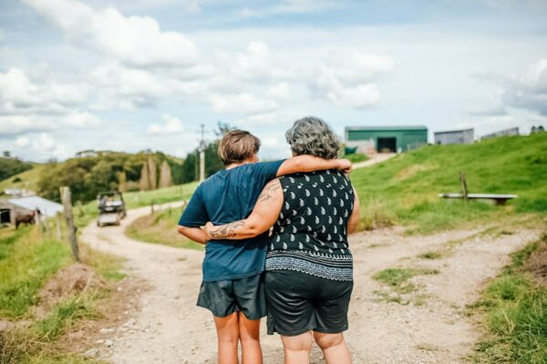
Land owners, stewards and managers need more comprehensive support when making land-use change decisions. Land-use diversification is expensive, and decisions are difficult to reverse in the short term.
Pohewa Pae Tawhiti (Visualising Horizons) is a collaboration with Te Arawa Arataua to develop a guided process for decision-makers to compare their current situation with land-use alternatives, based on tikanga and mātauranga Māori combined with innovative tools, models, and the most extensive data sets available.
Crucial factors such as the landowners’ principles, values, aspirations, and priorities for their land are being incorporated into the framework so that land-use change options support their vision.
The research team includes key members from Te Arawa Arataua who are working on the ground with a Te Arawa farming entity to test and develop the project framework. This framework will then be tested with other iwi and a corporate farming body.
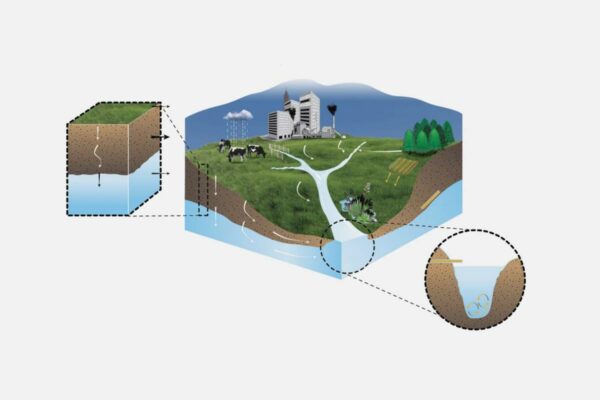
Pohewa Pae Tawhiti is closely aligned with the Land Use Opportunities – Whitiwhiti Ora programme, linking to datasets on alternative land uses, climate, and biophysical data that will help support land-use diversification assessments.
Matatau Whenua, a project associated with Pohewa Pae Tawhiti, investigates how tikanga, kōrero pūrākau and other forms of cultural knowledge can be incorporated into land use decision-making in managed landscapes. It is empowering whenua Māori landowners and decision-makers to make informed, culturally grounded land-use decisions by providing them with the Matatau Whenua Guidelines. These guidelines offer a clear, structured process for incorporating traditional Māori knowledge, or mātauranga, into decision-making. By guiding users through three phases and nine stages, we ensure that historical and ancestral knowledge is thoroughly considered, helping to shape the future of the whenua in a way that honors its past.
E aha ana mātou?
Kei te hiahiatia e ngā kaipupuri whenua, e ngā tāngata tiaki whenua, e ngā kaiwhakahaere hoki te tautoko matawhānui ake ina whakatau ana i ngā whakatau huringa whakamahinga-whenua. He nui te utu o te whakakanorau whakamahinga-whenua, ā, he uaua te whakahuri i ngā whakatau i roto i te wā tata.
Ko Pohewa Pai Tawhiti ko tētahi mahinga ngātahitanga ki a Te Arawa Arataua hei whakawhanake i tētahi tukanga e ārahina ana mō te hunga whakatau ki te whakatairite i tō rātou horopaki o nāianei ki ngā kōwhiringa kē mō te whakamahinga-whenua, i runga i ngā tikanga, i te mātauranga Māori tahi ki ngā taputapu me ngā tauira auaha, me ngā huinga raraunga tino whānui e wātea mai ana.
E whakaurua ana ki te pou tarāwaho ngā āhuatanga waiwai pērā i ngā mātāpono, i ngā uara, i ngā tūmanako, i ngā whakaarotau hoki o te kaipupuri whenua mō tōna whenua, kia tautoko ai ngā kōwhiringa huringa whakamahinga-whenua i tō rātou wawata.
Ka whakamātauhia tuatahitia tētahi tāhono kaiwhakamahi e whakauru ai te raraunga me ngā tohu ki te hōputu e tukuna ai te hunga whakatau ki te whakatairite i ngā tini horopaki whakamahinga-whenua.
Ko tētahi whāinga o te tukanga ko te whakamanapori i te rapu whakatau i roto tonu i te mana whakahaere o ngā hinonga whenua, hei whakarite kia whai whakaarohia ngā tirohanga kanorau.
Kei roto i te rōpū rangahau ngā mema matua nō Te Arawa Arataua e mahi ana i te whenua ki tētahi hinonga pāmu o Te Arawa hei whakamātau, hei whakawhanake hoki i te pou tarāwaho o te kaupapa. Kātahi ka whakamātauhia tēnei pou tarāwaho ki ētahi atu iwi, ki tētahi hinonga pāmu ahumoni hoki.
E hāngai tata ana a Pohewa Pae Tawhiti ki te hōtaka Land Use Opportunities – Whitiwhiti Ora, e tūhono ana ki ngā huinga raraunga mō ngā whakamahinga whenua kē, mō te āhuarangi, ki ngā raraunga koiora kiko hoki ka āwhina ai ki te tautoko i ngā aromatawai whakakanorau whakamahinga-whenua.
How can the research be used?Ka pēhea e whai take ai te rangahau?
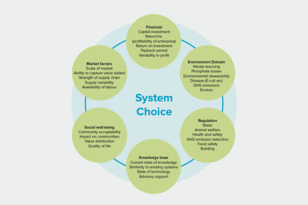
- The key output from Pohewa Pae Tawhiti will be a set of considered and assessed land-use options that can be used to outline the long-range strategic direction for decision-makers. This will help people share their vision for the land with others involved in decision-making, to provide the rationale for why decisions are taken and help support the clear communication of decisions to others.
- This set of land-use options, along with key metrics and indicators, can be used in an in-depth due diligence and investment analysis process.
- A user interface will be prototyped that integrates data and indicators into a format that allows decision-makers to compare different land-use scenarios.
- For Māori land trusts, this research aims to support more democratic decision-making, enabling effective input from a wider group of trust members to ensure diverse perspectives are considered.
- An associated research programme, Land Use Opportunities: Whitiwhiti Ora, will contribute methods to establish economic and environmental on- and off-farm impacts of on-farm activities.
- Incorporating traditional knowledge, the Matatau Whenua Guidelines provide a structured framework for whenua Māori landowners and decision-makers to integrate traditional Māori knowledge, or mātauranga, into their land-use planning. By following the three phases and nine stages outlined in the guidelines, users can systematically gather and apply historical and ancestral knowledge to inform both present and future decisions.
- The guidelines serve as a practical tool by offering key questions and protocols at each stage, helping decision-makers prepare and gather the necessary mātauranga about their land and people. This ensures that land-use decisions are well-informed, culturally grounded, and aligned with the holistic understanding of the whenua.
Ka pēhea e whai take ai te rangahau?
- Ko te putanga matua mai i a Pohewa Pae Tawhiti ko tētahi huinga kōwhiringa whakamahinga-whenua kua āta whakaarohia, kua aromatawaihia hoki ka taea te whakamahi hei whakatakoto i te aronga rautaki karioi mō te hunga whakatau. Mā konei e āwhina ngā tāngata ki te tuari i tō rātou wawata mō te whenua ki ētahi atu e whai wāhi ana ki te rapu-whakatau, hei tuku i ngā take mō ngā whakatau, hei āwhina hoki ki te tautoko i te kōrero mārama atu i ngā whakatau ki ētahi atu.
- Ka taea te whakamahi i tēnei huinga kōwhiringa whakamahinga-whenua, tahi ki ngā inenga me ngā tohu matua, ki tētahi tukanga haurapatanga hōhonu me te tātari haumitanga.
- Mō ngā taratahi whenua Māori, e whai ana tēnei rangahau kia tautoko i te rapu-whakatau he manapori ake, e whakaahei ana i te whakaurunga whaitake mai i te rōpū whānui ake o ngā mema taratahi.
- Mā tētahi hōtaka rangahau tuihono, arā mā, Land Use Opportunities: Whitiwhiti Ora, e tuku ngā tikanga hei whakatū i ngā pānga ā-ohaoha, ā-taiao hoki o ngā mahi kei te pāmu, kei waho hoki i te pāmu.
Research team Te hunga i whai wāhi mai
Science Lead
Tanira Kingi
Scion
Te Ao Māori Lead
Te Taru White
Te Arawa Primary Sector Inc
Project Lead
Tina von Pein
Development Matters
Val Snow
AgResearch
Helen Percy
AgResearch
Kēpa Morgan
Mahi Maioro Professionals
John Reid
University of Canterbury / Earth Quotient
Grace Walker
JD Reid Ltd
Rogerio Cichota
Plant and Food Research
Jay Whitehead
Matatihi
Bill Young
Ngāti Kearoa Ngāti Tuara
Te Arawa Primary Sector Inc
Paula Blackett
NIWA
Nick Spencer
Manaaki Whenua Landcare Research
Robbie Price
Manaaki Whenua Landcare Research
Sylvia Tapuke
Scion
Jade Kameta
Mahi Maioro Professionals
Oliver McMillan
Mahi Maioro Professionals
Raimona Inia
Mahi Maioro Professionals
Corey Ruha
Te Arawa, Tūwharetoa, Raukawa
Independent researcher
Tools & resources Ngā utauta me ngā rauemi
Infographic
Matatau Whenua Guidelines – Infographic
The Matatau Whenua Guidelines will assist whenua Māori landowners and decision-makers incorporate traditional Māori knowledge, or mātauranga, into land-use decision-making. The guidelines, are divided into…
Video
Waerenga Trust, Matatau Whenua Research
The whānau of Waerenga East and West Incorporation join the Matatau Whenua project team to explore the whenua which the Matatau Whenua Guidelines come from.…
Video
Our Land and Water Podcast Series
Our Land and Water introduces insights from eight years of science in this podcast series. In each episode you will hear from the scientists and…
Video
Our Land and Water Podcast Episode 7: How Māori agribusiness appoaches could lead the way
Māori ways of thinking about land and water offer insights into ways of growing food that are more resilient, healthy and prosperous. In this episode…
Video
Our Land and Water Podcast Episode 8: How do we feed Kiwi families and communities?
We grow more food than we need in Aotearoa and yet many people are going hungry. So how do we connect production and distribution to…
Academic outputs He whakaputanga ngaio
Journal Article
Pohewa Pae Tawhiti (Visualising Horizons): a Māori holistic approach to the co-design of land-use systems
Exploring alternative land-uses, particularly alternatives to traditional productivist systems, is a key part of the transition towards sustainable future agricultural systems. However, decision-making around agricultural…
Journal Article
Towards best-practice inclusion of cultural indicators in decision making by Indigenous Peoples
The purpose of this article is to explore the state of knowledge of cultural indicators internationally and in Aotearoa New Zealand. Cultural indicators are a…
Journal Article
Modeling Water Quality in Watersheds: From Here to the Next Generation
In this synthesis, we assess present research and anticipate future development needs in modeling water quality in watersheds. We first discuss areas of potential improvement…
In the media Mai i te ao pāpaho
Country-Wide podcast, 2 August 2024
Related news
Future Landscapes Projects
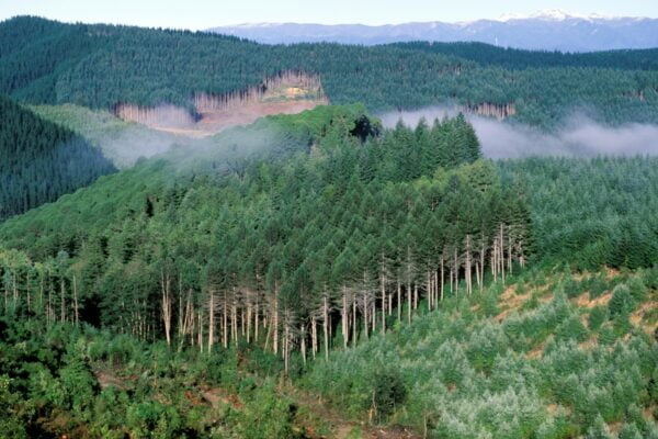
Visualising Forestry Harvesting Cycles
Future risk planning through the visualisation of forestry harvesting cycles. For full information see the programme website
This project has produced
Matarau: Empowering Māori Landowners in Land Use Decisions
Providing accessible and useful data to support Māori landowners to prioritise land-use options. For full information see the programme website
This project has produced
Next Generation Systems
Identifying next generation primary production systems and opportunities to change the face of farming
This project has produced
Sources and Flows
Managing contaminant pathways and attenuation to create headroom for productive land use.
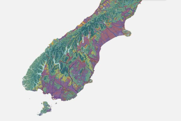
Physiographic Environments of New Zealand
Integrating landscape process knowledge with water chemistry to understand how and why surface water quality varies across New Zealand
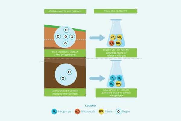
Benign Denitrification in Groundwaters
Developing a cost-effective technique to assess denitrification processes and end products in shallow groundwaters