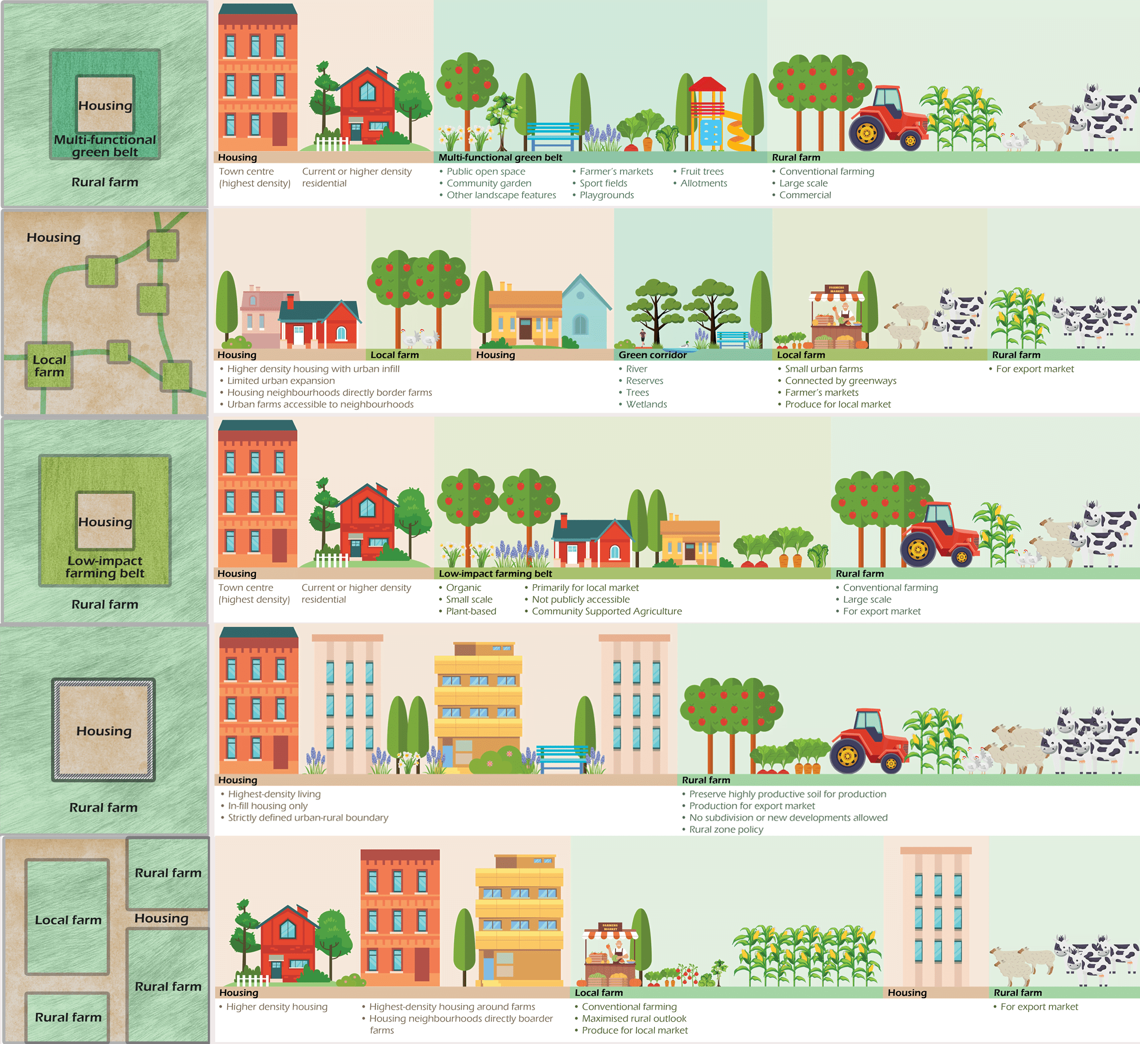
Five conceptual land use scenarios for the peri-urban zone
June 2024
Residents and people who farm on the outskirts of Ōtautahi Christchurch were asked to rank five different peri-urban designs. The infographic shows the findings of these rankings from most-preferred (top) to least-preferred (bottom).
1. Multifunctional green belt. This green belt acts as a buffer to the rural farms, and includes such activities as public open spaces, community gardens, sports fields, allotments, walking tracks, native plantings, stormwater management zones and playgrounds. The greenbelt is publicly accessible.
2. Urban farms connected by green corridors. This design sees existing public open spaces converted to farms, along with any new residential development required to include planned urban farms. These farms would be linked by public ‘right of ways’ and green corridors. The farms here would be small and diverse with a focus on supplying locals.
3. Low impact farming belt. This scenario consists of organic, small scale, plant-based farms that produce kai primarily for the local market. While the belt itself would not be publicly accessible, it would host a range of community food outreach such as farmers markets.
4. Hard urban/rural boundary. This approach sees housing and urban growth as being limited to the existing footprint of the urban area, to protect the fertile soil that surrounds the township and leave it for commercial farmers to produce food on. In this scenario, the food produced is mainly for export.
5. Farm-based neighbourhoods. This concept sees farming as the dominant landscape in the peri-urban zone. High density housing corridors would sit between farms. The farms closest to the existing township and dense housing areas would focus on supplying locals, but the farms further away from housing areas would focus more on export.
Source: Peri-urban landscapes and the potential of integrated foodscapes to support healthy cities: an Aotearoa New Zealand case study. https://doi.org/10.1080/23748834.2024.2348284
 View Our Strategy Document 2019 – 2024


