 View Our Strategy Document 2019 – 2024

August 30, 2024


Future Landscapes
In the future, landscapes will contain mosaics of land use that are more resilient, healthy and prosperous than today

Science Theme Leader
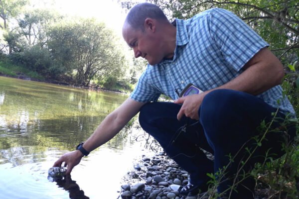
Susie McKeague – Director, Farm Environmental Consulting
New Zealand’s agricultural landscape is dominated by large farms that produce single products, on land classified according to its maximum capability. Over time, in many cases this has resulted in undesirable environmental outcomes.
Future Landscapes researchers developed the concept of “land use suitability” to describe not just the land’s capability to grow a product, but also consider impacts on soil and waterways, and economic, social and cultural outcomes. We applied a te ao Māori interconnected and intergenerational perspective which adds depth to this approach.
Our research gave land owners and regional councils the tools and models to identify distinct ‘zones’ of land according to a precise understanding of the sources and flows of contaminants, backed by reliable data. We identified and tested novel production systems to give farmers, growers and mana whenua a greater choice of profitable land use options.
Our research will help land owners choose the right product to grow or farm in the right place, developing a diverse ‘mosaic’ of land uses that are more resilient, lead to healthier land and water, and provide more income security than today.
Our Goal
The land and water in our productive environment is in a state that reflects our values as New Zealanders and meets the expectations of those abroad. Decisions on land-use change and management practices are able to be made with confidence, leading to measurable and substantial improvements in catchment land and water quality.
Future Landscapes Projects
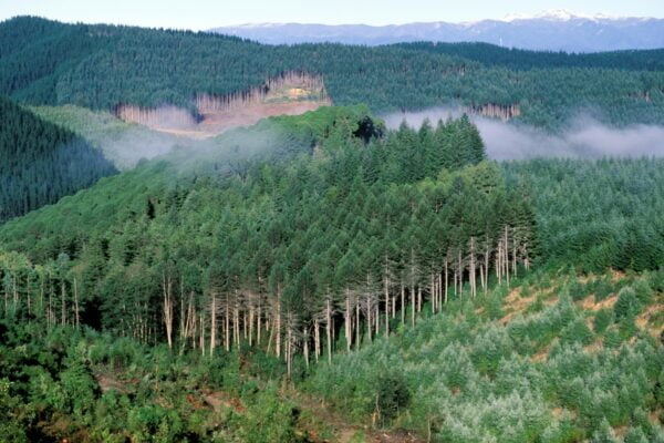
Visualising Forestry Harvesting Cycles
Future risk planning through the visualisation of forestry harvesting cycles. For full information see the programme website
This project has produced
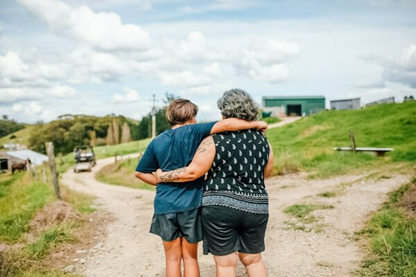
Matarau: Empowering Māori Landowners in Land Use Decisions
Providing accessible and useful data to support Māori landowners to prioritise land-use options. For full information see the programme website
This project has produced
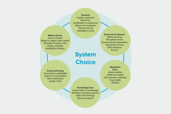
Next Generation Systems
Identifying next generation primary production systems and opportunities to change the face of farming
This project has produced
Healthy Estuaries
Assessing the interactions between loadings of different contaminants from freshwaters on the health and functioning of estuaries
This project has produced
Phosphorus Best Practice
Investigating whether current fertiliser and effluent guidelines and policy are strong enough to prevent phosphorus loss
Land Use Suitability
Land use suitability tools and assessment processes for increasing land use diversity and delivering better community outcomes.
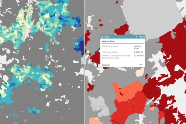
Sources and Flows
Managing contaminant pathways and attenuation to create headroom for productive land use.
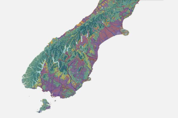
Physiographic Environments of New Zealand
Integrating landscape process knowledge with water chemistry to understand how and why surface water quality varies across New Zealand
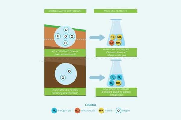
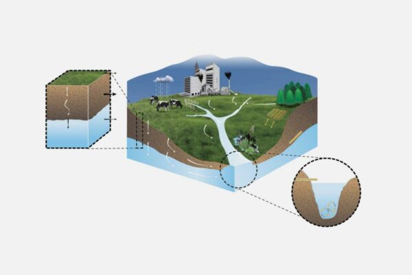
Benign Denitrification in Groundwaters
Developing a cost-effective technique to assess denitrification processes and end products in shallow groundwaters